Catarata De Yumbilla, Peru


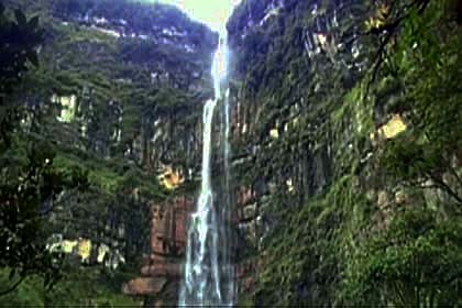
The Amazon region of South America is a magnet for travelers interested in adventure, eco-tourism, science, and sustainable practices. A few years ago, the Tourism Board and Chamber of Commerce of the Peruvian Amazon region set out to rediscover the potential of its pristine waterfalls. Part of this effort included taking a formal measurement of the Catarata De Yumbilla, Peru, a magnificent waterfall in the Cuispes District of the Bongara province.

At the behest of the Mayor of Cuispes, geodesy experts from Peru’s National Institute of Geography determined that the height of the Yumbilla waterfall measures an impressive 896 meters, approximately 2,940 feet. This would make Yumbilla the third highest waterfall in the world, just behind the Angel Falls in Venezuela and the Tugela Falls in South Africa. The measurement has been subject to some challenges, but the event managed to renew interest in the great tourism potential of the area.Catarata De Yumbilla, Peru
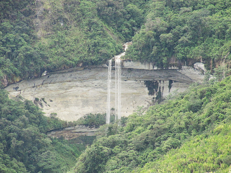
Yumbilla is the largest waterfall in the Peruvian Amazon, a region that has been blessed with 24 pristine Waterfalls of South America. Yumbilla has four different vertical streams from brink to base. The terrain surrounding the falls is mountainous but hospitable, with green forests and thick canopies of varying heights. The brink of Yumbilla is known as the Cueva San Francisco de Yumbilla, a cave that measures five meters in height and nine meters across. The depth of this intriguing cave has not been fully determined, but villagers from Cuispe have been known to descemd 250 meters.


Since the Yumbilla falls were remeasured in 2007, a greater influx of adventure travelers and eco-tourists are exploring the region. A trail running down from the San Francisco cave to the base of Yumbilla measures about 5.7 km, and it leads to a viewing area known as “Sal Si Puedes” (Leave If You Can). This interesting name refers to the captivating natural beauty that hikers experience when they visit. Walking down to the base means being treated to the deafening roar and constant spray and mist as water hits the rocky bottom.

Visitors will be impressed with the hospitality in Cuispes, where the locals offer expert guides, horseback riding, and great food. The area is teeming with wildlife and unique orchids, and there are two other waterfalls that can be explored in a two-day span. Cuispes is a sleepy agricultural town that has only recently began to experience eco-tourism, but it is trying to extend its range of services to visitors in terms of lodging and guided tours.
Share

Catarata De Chinata, Peru


 Peru is home to many natural wonders, but none compare to the spectacular sights at Catarata De Chinata. As you stand at the bottom of one of the world’s greatest natural masterpieces, you’ll see water plunging out of the sky from 580 meters in the air. If you choose to stand close enough to the waterfall, you’ll feel a cooling mist that is quite refreshing on a hot day in Peru. What makes this waterfall unique is the fact that the water doesn’t come straight down from one edge to the bottom. Catarata De Chinata is an awe-inspiring spectacle for everyone to behold.

Catarata De Chinata, Peru Photo by Peru Top ToursCatarata De Chinata has water that falls in layers. The water drops for a bit, and then it levels off on a small valley. The water falls again, and once again levels off at a small valley. The rest of the water finally falls toward the jungle below. A quick hike up the waterfall from the village of Cuispes offers tourists the best views of the majestic waterfall. You only have to walk for about 45 minutes to reach the point where you can take the clearest pictures of the water cascading down toward the ground below.

Visitors who enjoy Catarata De Chinata will also find amazement in another nearby waterfall. Catarata de Yumbilla, located a short distance away, is another majestic waterfall that has falling water in levels. Tourists who come to this area to see waterfalls never leave disappointed. The local culture in Peru embraces the waterfalls as part of their lives, and they welcome tourists to appreciate the stunning beauty found within each waterfall. This area of Peru is worth exploring due to the variety of different geological processes going on here. If you enjoy seeing the natural earth in all its glory, then this Waterfall of South America is the place for you.


The Amazon forest, where the falls are located, is a splendor in every sense of the word. After you explore the waterfalls, you can make your way through Peru’s portion of the breathtaking jungles. People who visit this section of the Amazon gladly report that they enjoy their experiences. In addition to the waterfalls, you also see exotic plants, animals, and ecosystems all working together. Peru travelers often remark that they would visit again if they were granted the opportunity. Peru’s waterfalls provide a unique backdrop to the wonders of nature.

Share

Chorrillo del Salto


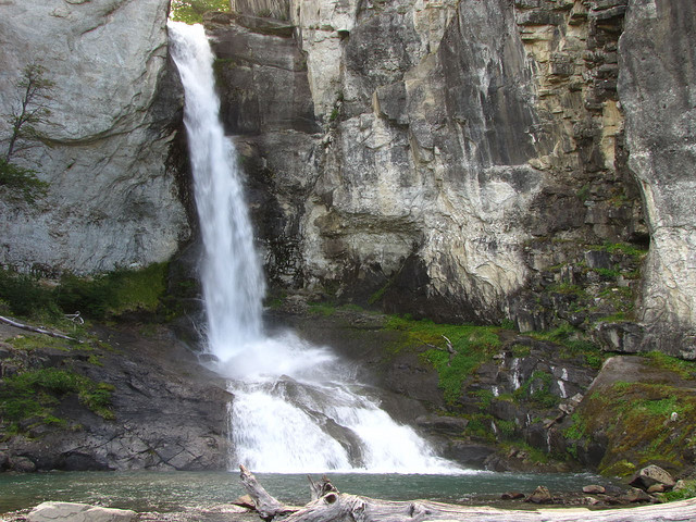
Chorrillo del Salto is one of the world’s most beautiful and tranquil waterfalls. Located in the heart of Patagonia in the Los Glaciares National Park, Chorrillo del Salto offers a pleasant experience for those who wish to see nature in all of its splendor without having to contend with massive hoards of tourists.

This Waterfall of South America is just under 66 feet (20 meters) tall. The east facing falls glisten in the morning sun, but are just as beautiful in the evening shade. Those wishing to admire Chorrillo del Salto will need to be prepared to hike a short distance up a dirt path. The trail is about 1/3 mile (500 meters) long. Those who seek more adventure can attack the a path that travels alongside the falls.

Chorrillo del Salto, Patigonia, Argentina, Photo By Ing. Alvin's Most visitors to this area begin their journey in El Calafate. Many fly into the Comandante Armando Tola International Airport. They then explore this area before traveling north to El Chalten. El Calafate is popular because it gives tourists access to the Perito Moreno Glacier. Perito Moreno is one of the most visited glaciers both for those who wish to trek it and for those who simply want a view of its natural beauty.

The closest town to Cascada Chorrillo del Salto is El Chalten. The village is about one mile (3 km) from the waterfall. El Chalten is known to host those seeking adventure. Mountain climbers and hikers enjoy the challenges of the nearby Cerro Torre and Monte Fitz Roy peaks. El Chalten has a few spots with accommodations for tourists as well as restaurants and shops for outdoor equipment. There are also free campsites near the town.


The drive between El Calafate and El Chalten offers a unique view of the bodies of water of Patagonia. A paved road takes travelers around Argentino Lake and Viedma Lake. Argentino Lake is the largest freshwater lake in Argentina. Many visitors stop for boating or fishing. Northwest of El Chalten is a third waterway that is popular with adventure tourists. San Martin Lake is notable for being the deepest lake in the Americas. It is also notable for being claimed by both Argentina and Chile, which calls the lake O’Higgins. Visitors can take a ferry to reach O’Higgins on the Chilean side.

Share

Gocta Catarata, Peru


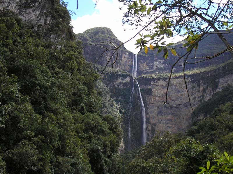
The Gocta Catarata, located in Peru, is one of the tallest waterfalls in the world. It is also one of the most recently discovered Waterfalls of South America and publicized. The waterfall has been well known by local residents of the region and was visible from the native village of Gocta but was not documented by the world’s geographers. According to legend, the locals did not talk of the waterfall because of fear of angering a mermaid that lived within the waters.

In 2005, a group lead by Stefan Ziemendorff officially documented the existence of the waterfall in the remote regions of the Chachapoyas province. The waterfall was then mapped and attempts were made to document its dimensions. The process of documenting the height of the waterfall is incomplete and there are still controversies associated with where this waterfall ranks among the tallest waterfalls of the world.Gocta Catarata, Peru Photo By,jayit0's

Gocta Catarata falls in two segments. Ziemendorff measured the total height of the waterfall at about 2,500 feet or 770 meters. Those measurements would rank Gocta as the third tallest waterfall but have been disputed.

Because of the remote location of the waterfall, visitation is limited to dedicated backcountry travelers. The Peruvian Government is attempting to improve the conditions and exploit the waterfall as a tourist destination. This includes lodging and trails within sight of the Gocta Catarata.

Even the best lodgings in the area are at altitudes exceeding 7,500 feet or 2,200 meters. These locations are still below the base of the waterfall and involve an uphill hike to the actual waterfall location. The high altitude means thinner atmosphere and can cause hikers to tire quickly. The high altitude also means that the weather can be unpredictable and high clouds can conceal parts of the waterfall even when viewed from the base of the falls.


The province of Chachapoyas has a population of about 50,000 people scattered over 3,300 square kilometers or 1,300 square miles. The region is known for its local populations of indigenous people who maintain cultures that are representative of the local civilizations prior to the arrival of European populations in the 1500s.

The region supports a small tourist industry that does include Gocta Catarata. However, the economy of the province is principally based on agriculture.

Share

Salto Hacha, Venezuela


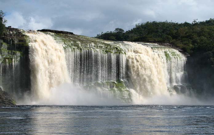
Salto Hacha is by no means the most famous waterfall in Venezuela. Generally overshadowed by nearby Angel Falls, the world’s largest waterfall, Salto Hacha often first appears to visitors as a side stop on an itinerary headed toward the big show. Despite its more humble reputation, Salto Hacha is a unique and unforgettable location with much to offer those adventurous enough to seek it and making the falls one of the more popular Waterfalls of South America.

Located in the world famous Canaima National Park Lagoon, inside of the UNESCO World Heritage Site Canaima National Park, Salto Hacha is part of a large natural reserve with unique flora, animal life and one-of-a-kind rock formations. While visiting Salto Hacha, visitors may be lucky enough to spot monkeys, giant anteaters, three-toed sloths, jagurs and poison arrow frogs in addition to hundreds of species of orchids and other exotic fauna.Salto Hacha Waterfall, Venezuela

Tourists visiting Salto Hacha are allowed to climb behind the waterfall’s curtain and get a truly insider view of one of the world’s most incredible locations. The trails that go behind the falls are slippery and it is recommended that visitors bring shoes appropriate for climbing on wet terrain.

Salto Hacha also boasts a nearby beach that tourists can visit after their climb. The over-presence of quartz in the Canaima National Park Lagoon gives the water and sand a unique ambiance. Although the water remains clear, it takes on a unique rusty or tea-like appearance, while the sand appears red and even pink in spots. The Lagoon is known for gentle waters and tourists can swim peacefully surrounded by breathtaking views of some of the world’s most famous waterfalls.


Salto Hacha should not be approached independently. With remote, tough terrain and strict government regulation to protect the fragile eco system, travelers will need to acquire a guide. It is not difficult to find tour companies operating out of Caracas or Ciudad Bolívar with prices varying throughout the seasons. Prices from Ciudad Bolívar tend to be more competitive.

All tourists flying to Canaima National Park must be able to prove that they have received a recent Yellow Fever vaccination. Those who cannot provide proof will be required to receive a vaccination at the airport. The climate in Canaima National Park is tropical and usually rainy with a dry season lasting from December to April. Toward the end of the dry season, Salto Hacha and the other waterfalls may slow to just a trickle.

Share

Iguazu Falls


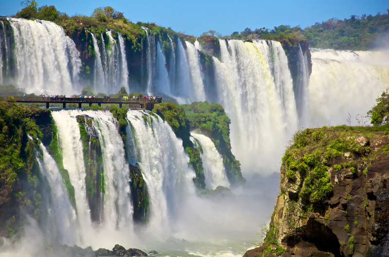
Dividing the Iguazu River into the upper and lower Iguazu, Iguazu Falls is a gorgeous and highly impressive group of over 200 waterfalls. Much taller and wider than Niagara Falls, Iguazu Falls is often compared to Africa’s tremendous Victoria Falls. Fantastic vistas and beautiful flora and fauna await visitors to the area, and adventures abound.

Iguazu Falls is located partially in Brazil and partially in Argentina and the Falls are shared by the Iguazu National Park in Argentina and the Iguacu National Park in Brazil. The area is highly protected as a natural jungle ecosystem and remains a pristine area full of beautiful plants, trees, and rainforest animals. Iguazu Falls enjoys a subtropical climate with warm temperatures year-round. Perhaps the best time to visit is in the fall and spring when temperatures and humidity are ideal.Iguazu Falls as seen from Argentina

“Iguazu” derives from Guarani words for “water” and “big”. Iguazu Falls is located where the Iguazu River falls over the edge of the Parana Plateau. The Falls are made up of hundreds of falls, but perhaps the best known is Devil’s Throat, which is U-shaped, 82 meters high, and 150 meters wide. The border of Argentina and Brazil actually runs right through Devil’s Throat. Two other notable falls amongst the many at Iguazu Falls are the San Martin Falls and Bossetti Falls.


Access to Iguazu Falls is quite simple, making the falls one of the most popular Waterfalls of South America. There are two main towns on either side of the falls: Puerto Iguazu in Argentina and Foz do Iguacu in Brazil. Both countries protect the ecological area rigidly, but they also provide ample ways to enjoy the beauty of the falls. From the Brazilian side, there is a walkway along the canyon that leads down to the bottom of Devil’s Throat. There are also other hiking trails, helicopter rides offering aerial views, and a new transportation system consisting of double-decker buses that provide spectacular viewing opportunities. On the Argentine side, visitors can access the falls by way of a ride through the forest on the Rainforest Ecological Train, which brings visitors to the entrance of Devil’s Throat and other trails. There are also boats available that actually go under the falls.

Share

Kaieteur Falls, Guyana


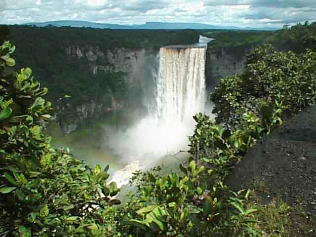
Waterfall enthusiasts consider Kaieteur Falls of Guyana, South America, one of the top scenic Waterfalls of South America. The fall features a high volume of water falling more than 250 meters or 800 feet. The great quantity of water, coupled with the distance the water falls, may make the Kaieteur Falls one of the most physically powerful natural phenomenon in the world.

The fall occurs on the Potaro River as it drains a range of mountains in northern Guyana. The Kaieteur is the largest of about nine waterfalls along the course of the river. The river is also noted for its indigenous people as well as the gold and diamonds mined from the riverbed and surrounding area.

Kaieteur Falls Guyana, South AmericaThe waterfall was unknown to European mapmakers until the 1870s when geologists exploring the area for mineral wealth came across the falls. Over a number of years, the location was mapped and the height and volume of the falls were estimated. Traditionally, the falls name is associated with a native legend describing a chief known as Kai who sacrificed his life by going over the falls in an effort to save his people from the wrath of the spirits.

The waterfall is the centerpiece of Kaieteur National Park and a major attraction in the area. Officials established the park in 1929 which is administered by a commission. The park’s stated purpose also includes preserving the wildlife and jungle plant life native to the region.


International travelers planning to visit Kaieteur Falls can arrange a flight to nearby Kaieteur International Airport. This airport often serves as jump off point for expeditions to the waterfall and the park. The airport’s elevation of about 1,500 feet or 450 meters along with a runway length of just 2,000 feet or 600 meters limits the airport to serving smaller aircraft which shuttle people to and from the larger airports of the region.

From the airport or the nearby roads, travelers can walk to the location of the falls. This is about a three mile or six kilometer trail. The power of the waterfall and its close proximity to travel connections makes Kaieteur Falls a popular destination for adventure travelers.

Share

Chichen Itza Ruins, Mexico

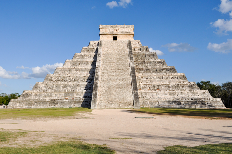
Chichen Itza Ruins, Mexico (“at the mouth of the Itza well”), the ruins of a grand Mayan city, is a must-see for the Central American and Mexican tourist. Besides being the second most popular tourist destination, it was named a UNESCO World Heritage site in 2007. This expansive compound makes up one of the most colossal Mayan sites.

Chichen Itza Ancient Ruins in MexicoAlmost a millennium before Columbus reached the New World, the Mayans were thriving on a limestone plateau on the northern Yucatan peninsula. The Chichen Itza ruins are surprisingly well-preserved and easy to reach from Mexico’s larger cities making this a ideal destination for travelers on low cost holidays. The remains of the theosophy of the Toltecs and Mayans display painstakingly artistic detail in stone.

Chichen Itza was built in around 600 A.D., and was initially intended primarily as a place of worship. In fact, it was the primary location of religious rites in the entire Yucatan. Its population reflected these spiritual origins. Chichen Itza’s population grew steadily until 800 A.D., when citizens abandoned all Mayan cities.

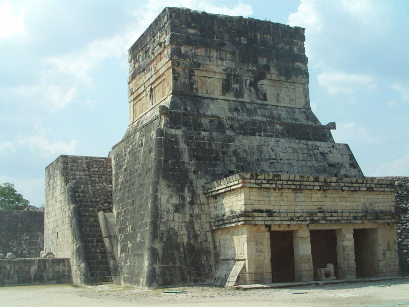
Ball Court entrance Chichen Itza Mexico mdTwo centuries later, different Mayan peoples resettled the city during the Mayan-Toltec era, and everyone moved west to Mayapan. No one knows why.

The ruined city’s favored deity is the plumed serpent Kukulkan, whose 78-foot high temple is the most famous in all of Chichen Itza. Unlike Egyptian pyramids, El Castillo (“castle”) has only four sides.

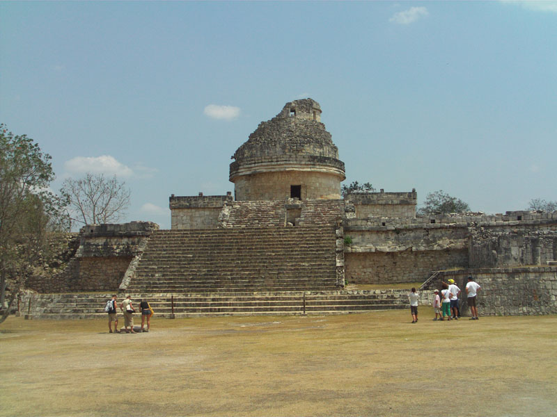
The Observatory Chichen Itza MexicoThe entire structure serves as a solar calendar. On every day, the sun shades a different step of the stairway to the apex (91 in all). Among other functions, the pyramid was an aid in the timing of crop plantings.

Besides paying homage to Kukulkan, the temple was built to study the cosmos, as was the Platform of Venus. This spiritual structure was named one of the seven wonders of the modern world.

Chichen Itza features a sports field abutted by shrines at its borders. Still other shrines exist in honor of revered animals, like the jaguar and eagle. The upside is that the athletes were proficient. The downside is that the city’s Toltec influences dictated that losing teams were often sacrificed to the gods.

El Caracol (“conch shell), an astronomical observatory was built here, with windows set into a stone dome, an amazing architectural feat. When Mayans looked through specific windows on exact dates, they could observe designated celestial bodies.

Chichen Itza is easily reached from hotels in either Cancun or Merida, the closest city. It white limestone and prevalence of white buildings have earned the Yucatan’s capital the nickname of the White City.

Although it showcases modern fashion and a unique flair, Merida also reminds the Mexican traveller of Colonial days. The town is remarkably compact, and it is easy to see the sights on foot.

The six million modern Mayans, although racially diverse, continue to honor the old ways, as they:

• Grow the ancient foods of tomatoes, squash, corn, beans and chiles

• Practice herbal medicine and eschew Western techniques

• Favor Mayan dialects to speaking Spanish

• Celebrate a mixture of ancient Mayan religious beliefs and Catholicism

Share

Sacred Valley, Peru

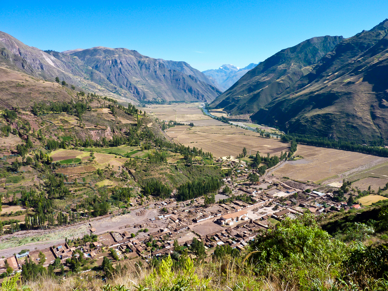
Near the top of the world at 7,000 to 9,000 feet above sea level in the Peruvian Andes is found the Sacred Valley of the Incas, where natural beauty and history abound. The Sacred Valley is close to Cusco, originally the capital of the Inca Empire, the largest empire during pre-Columbian America.

Sacred Valley of PeruThe fascinating history of the Incas, and the ruins to be found in the Sacred Valley make this a remarkable place to visit. Couple the ancient ruins with the present day people and their rich culture, their hauntingly beautiful music, their gorgeous woven blankets, and one will have a never-to-be forgotten experience.

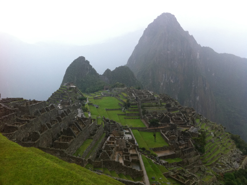
Probably the greatest legacy the Incas left to posterity is the ruins of their amazing architecture. Today, many visitors are awed by the majesty of the ruins of Machu Picchu, which translates into “Old Peak.”

Machu Picchu, PeruMachu Picchu is 50 miles northwest of Cusco and the start of the Inca Trail. It had been completely forgotten for hundreds of years after the Spanish conquered the Incas, until Hiram Bingham discovered it on July 24, 1911. It became a popular tourist destination after The National Geographic Society devoted the April 1913 edition of the magazine entirely to Machu Picchu.

In 1983, Machu Picchu was designated a World Heritage Site by UNESCO, described as “an absolute masterpiece of architecture and a unique testimony to the Inca civilization.”

The architecture of Machu Picchu is constructed of polished dry-stone walls with the technique referred to as ashlar. Blocks of stone are placed on atop one another then cut to fit the stone below. This technique results in stones that are so tightly fitted that they do not need mortar. A knife cannot even be slipped between the stones.

Cuzco, the capital city of the Cusco region, is a beautiful red-roofed city of approximately 360,000 people. The name of the city originated from the phrase "qusqu wanka" meaning “rock of the owl.” This came from the myth of Ayyr Auca who, it is said, grew wings and flew to the site of the city, turning himself to a rock owl to lay claim to the area for his people.

Cuzco is a major destination for travelers to Peru. Many visitors will start their Inca Tours in Cusco. The beautiful red-roofed city is a welcoming sight as one flies into the airport. The arts and food are lauded by visitors. Not to be missed is the ChocoMuseo – the Chocolate Museum, where the artistry of creating with chocolate is taken to an inspiring level.

Share

Espanola Island Galapagos


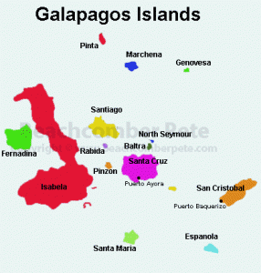
The oldest island in the Galapagos Archipelago is Espanola Island. It is also known as Hood Island, and is a 10 to 12 hour boat ride from Isla Santa Cruz. Those planning to travel to this area should be aware that during the months of August and September the seas could be quite rough near the island. Espanola was formed through volcanic action, as were all of the Galapagos Islands. It is the oldest of the islands and testing revealed that the lava here is around 3.4 million years old. Today, the volcano on Espanola is extinct and because it is a rather low island, it is dry and quite inhospitable. However, this island is still a very popular tourist spot.

Because of Espanola’s hostile environment and lack of a large amount of fresh water, there are no settlements on the island. However, it is due to this lack of interference from humans that certain wildlife has been able to thrive by adjusting to the environment of the island.

For instance, the Marine Iguana from Espanola is the only one that changes its colors during breeding season, unlike those on the other Galapagos Islands. Normally, the iguanas are black, allowing them to hide in the black lava on each of the islands. However, the Espanola Marine Iguana is a reddish color, except during breeding season when it is a greenish shade.

The Hood Mockingbird is another animal that is endemic to Espanola. This bird is not afraid of visitors and at times even lands on a visitor’s head. In addition, it is the only carnivorous species of Mockingbird, thriving on a diet of insects and turtle hatchlings.

Map of Galapagos Islands

At one point, the Saddleback Tortoises of Espanola nearly went extinct. By 1959, there were only 12 females and 2 males left on the island. In the 1960’s, scientists brought these tortoises, along with another male tortoise from a U.S. zoo, to the Darwin Breeding Center where a captive breeding program began. Today, because of the success of that program, there is again a growing population of the Espanola Saddleback Tortoises.

Espanola’s greatest highlight is its many species of birds. The steep volcanic cliffs make perfect homes for many of them. The most popular, and one endemic to the island, is the Waved Albatross. The island has the largest population of these birds whose nests can be found only on Espana. It is quite a sight when these birds, with their enormous wingspan, take off from the high cliffs on their way to their feeding grounds. Those who enjoy bird watching will be thrilled by the variety of birds here including the Galapagos Hawks, Masked Boobies, Swallow Tailed Gulls and the Red Billed Tropic Bird.

Espanola has two visitor sites, Punta Suarez and Gardener Bay. Punta Suarez is on the western end of the island. Travelers must make a wet landing here. Walking along a two-mile trail, the visitor will be able to see sea lions playing in the water, numerous birds cavorting in the sky, and the largest Marine Iguanas in the Galapagos. This area is also home to the Espanola Lava Lizards, as well as birds such as the Galapagos Doves, the Large Billed Flycatcher, the Galapagos Hawk and the always popular Waved Albatross.


On the east side of Espanola is Gardiner Bay. This area is a popular site for swimming and snorkeling. Its white sand beach makes this the perfect spot to relax and enjoy the surroundings. There are colonies of sea lions who like to sun themselves on the beach, as well Green Sea Turtles just off shore. Nothing can beat snorkeling in Gardener Bay with the sea lions swimming right alongside. Out a little further, there are large schools of colored tropical fish along with an occasional Manta Ray and White Tipped Shark.

Although Espanola is not habitable according to human standards, it is the perfect home for a unique group of animals. They have been able to adapt to extreme conditions and many exist only on this island. A visit to Espanola allows the traveler to view an area unchanged by man, something that is becoming rarer as time goes by.

Galapagos Islands

Baltra

Espanola

Fernadina

Isabela

San Cristobal

Santa Cruz

Santa Maria

Santiago

Ecuador

Passport/Visa

Share